Art enables us to find ourselves and lose ourselves at the same time. Thomas Merton

Friday, December 27, 2013

Goodby Little Gabby

I happened to be up about 4:00 a.m., headed into the kitchen to get some water.  Matilda was making a lot of noise. On checking the bunnies, I found that  Gabby was down and it wasn't looking good. She had been fine and was not showing signs of any kind of problems. She was active when I fed them their supper last night. She was an old bunny at nine years, but seemed to be going strong. I guess it was time. I wrapped her up and held her until the end.

She loved getting to go out to the playpens.

Enjoying her perch in the playpen out back

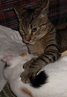
Stretched out in the shade in the front yard

Relaxing with her best bun, Matilda

Wednesday, December 25, 2013

Before and After

Cutting down our  tree at the Christmas tree farm on Sunday and all decorated on Christmas Eve. No ornaments, just lights, thanks to the cats.

Tuesday, December 24, 2013

Best Wishes to All

Merry Christmas to everyone.


Twinkie says


(These appear to be the only two Christmas photos I have stored in my phone, having failed to take any with it so far this year. We won't decorate our tree until tonight. Maybe some new ones then)


Sunday, November 24, 2013

In the Meantime...

I have not given up on my Trips West 2013 posts, even though I know some/most of you find them as exciting as home movies and slide shows (slide shows--remember when we had those things called slide carousels full of photos in slide format and bored family and friends with them at holiday get-togethers?). More to come. I have been a bit tied up with trying to finish some spinning projects and getting acquainted with a delightful little loom I have acquired. In the meantime, I'm sharing some equally exciting photos of random stuff that makes up my life. My apologies for the erratic spacing of the photos. I don't seem to have control of it or know what to do to fix it. Still working on that.

The spinning project. Hand dyed and blended by Yours Truly. Fiber is a blend of mostly alpaca, some sheep's wool, and a little bit of sparkly stuff.


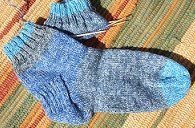
Some of the yarn. This thin stuff takes a while to spin. I'm almost finished with this step, but next I have to make 2-ply (2-strand) yarn out of it. That won't take as long once I get around to doing it. I have to knit a lacy scarf after I finish the yarn.
                                                                                                   
                                                  
New-to-me portable loom. A Schacht Baby Wolf. Folds up and fits into the back of the van so that I can carry it to workshops. (photo from the Schacht files)


A shot of the Baby Wolf (to give a better idea of its size) and my Majacraft Rose spinning wheel in the garage space that has become my temporary fiber studio while I rearrange space in the house to make room for the loom.


Daughter in the chemistry lab storeroom at UAH. Weird lighting makes it look like she has a black eye. It's just the shadow created by her hair.


Mt. Shasta at sunset with alpenglow. Photo taken by Number 2 Son. He's gone to California for a few weeks and is staying in the town of Mt. Shasta. He gets to look at this beautiful sight whenever they go anywhere.


His photo prompted me to do this small watercolor for him as a keepsake of his adventures in Northern California.


Ok, bear with me.  Only two more.

A photo of a photo and the real reason I haven't been doing much. My dear nephew doing what he loved--competing in mountain biking events. His favorite place to ride and compete was in the Colorado Rockies. I like to think that that's what he's doing now.


Last one.
We had a spectacular sunset the other day. Too bad there's no way to capture the beauty of it with a cell phone camera.


Wednesday, November 6, 2013

The Trips West 2013--Walnut Canyon National Monument

After a little sidetracking to do some hectic yarn spinning (fiber type yarn, not tall tales),  I'm back on the trail of places we visited during the summer.

Walnut Canyon National Monument (click for more info) is located near Flagstaff, Arizona. The monument is the site of some early inhabitants of the area who lived there from about AD 1100 to 1250. Exactly why they left is unknown. Personally, I'd say climbing up ladders to get home at the end of a day of tending crops would do it for me. Acutally, they might have been climbing down ladders to get to their dwellings if they planted crops up at the top of the canyon. There is considerable plant diversity in the area of the canyon. The inhabitants focused on growing corn (maize), beans, and squash--the "big three" of North American archaeology. The elevation at the top is 6700 feet and the bottom of the canyon is about 350 feet below. None of the cliff dwellings is accessible to the public, but may be viewed from the trails and visitor center.

A view of the cliff dwellings from the trail (you might need to click to enlarge)


Cliff dwellings as seen from the visitor center


Another view from the trail


Number 2 and Daughter at a stop along the canyon rim


Remains of a house along the canyon rim trail


Stay tuned. More to come. We still have Sedona, Meteor Crater, Petrified Forest, and more to cover.

Monday, October 21, 2013

The Trips West 2013--Wupatki National Monument


Because of my work as an archaeologist in another life, I had originally hoped to visit two well-known Southwestern archaeological sites of the ancient Pueblo cultures, Chaco Canyon and Canyon de Chelly, while in New Mexico and Arizona. See a map of the area here. After reading the AAA tour guide and park descriptions of less than ideal road conditions near Chaco Canyon (some 20 miles of unimproved, rocky and rutted road) and the warning that GPS devices might not be functional in all areas, I decided against trying to drive the last few miles to Chaco in our van. We were afraid there might be similar road conditions leading to Canyon de Chelly and decided to save both those stops for another trip.  Maybe next year. Instead, we decided to visit archaeological ruins of the same types of ancient Southwestern cultures in the Flagstaff area.  (Some photos were made with the camera instead of the cell phone, so clicking might yield closer looks. Also, underlined links were supposed to be highlighted in red, but Blogger is uncooperative today.)

Wupatki National Monument
More information is available here and here.


Just a few miles north of Sunset Crater Volcano near Flagstaff is Wupatki National Monument. Both sites are located about fifteen miles north of Flagstaff along a scenic loop that covers about 50 miles off US 89 beginning at Sunset Crater, then meanders along Route 395 back to 89 about 15 miles north of the Sunset Crater Visitor Center.  After our visit to Sunset Crater on our first day in Flagstaff, we decided to go back another day and spend some time at Wupatki. We did not try to cover the entire Wupatki site complex. A number of the 2500 documented sites of the complex are accessible by trails and we had a bit of a time trying to decide which to explore. We were trying to get to Sedona, AZ later in the day, so our ramblings took us to the Lomaki (Hopi for "Beautiful House") site where we walked among many abandoned structures of these ancient people.

Daughter near one of the houses constructed of sandstone blocks. These blocks were held together with mortar and portions of many are still standing, even though the site was abandoned sometime around AD 1200.

Another house ruin


The trail at one of the stops at Wupatki with No. 2 Son and a structure in the distance. Sunset Crater is visible on the left and the San Francisco Peaks on the right


Close up of that trail shot--No. 2 looking at a lizard with the house just beyond


More photos of some of the ruins


Looking through a doorway from one room into another


 Looking down over a collapsed wall into a box canyon above which the house had been built


Daughter and No. 2 inspecting on of the structures


A last look at Wupatki's Lomaki site with the volcanoes in the distance


Monday, October 14, 2013

The Trips West 2013--Sunset Crater National Monument

Although our May trip was originally planned for a duration of three weeks, my bout with bronchitis delayed our May 12 departure by three days, then changes in the schedules of Daughter and No. 2 Son required us to return home a few days ahead of our proposed date of June 1. We had to alter our original, loosely planned itinerary a bit. This allowed us to make it to the two things in which arrival time was important--Bat Flight at Carlsbad Caverns and our Grand Canyon helicopter and jeep tour--but we were still able maintain a leisurely and rather open schedule as much as possible. We played it by ear and made a few unplanned and really interesting stops that weren't on our original list. Here is one of them.

Sunset  Crater Volcano National Monument 


There are cinder cones and volcanic remnants all over the area we were exploring around Flagstaff. It was amazing. That area must have been a regular volcano farm--or  I could say a hotbed of volcanic activity (sorry...couldn't help it). There are about 600 volcanoes in the area. Go here for a map of the area showing all the volcanoes in the region. Sunset Crater is the result of an initial eruption sometime around AD 1180, although tree ring dating from house timbers yield earlier dates of about 1040 to 1060, but these are disputed because of lack of information concerning the source of origin of the timbers. The people of the puebloan culture who lived in the area undoubtedly witnessed the eruption of this volcano and the ash from  its activity probably enriched the soil of these early Southwestern farmers. These small volcanoes are silent now, but could erupt again at any time. 

Sunset Crater Volcano from the road leading to the visitor center. Its total elevation is about 8,000 ft, with the cinder cone rising about 1,100 ft from the local elevation of almost 7,000 ft. My home elevation is just over 622 ft and the elevation of Monte Sano Mountain, Huntsville's landmark "mountain," is a little over 1600 ft, so even in the lowlands out here we were as high as the highest elevations in the Smoky Mountains of the Appalachians (Clingman's Dome at around 6640 ft).


Lava beds


A view from the lava trail we hiked around the crater. I supposed you'd call this the back side. There is a trail that goes up to the summit, but it had to be closed in 1976 because of the risk of increased erosion.


And another view


There were many beautiful old snags that provide homes for lots of critters--look, there's one now!
No. 2 Son and a fallen snag


No. 2 and Daughter beside another fallen snag;  the San Francisco Peaks and Humphreys Peak (elevation 12,635 ft)  in the distance


Daughter, a standing snag, and cinder cone


More lava beds


We spent four nights in Flagstaff, Arizona, which became our base camp for exploring the area.  There are many interesting things to see in and around Flagstaff.  I think we could have spent at least a week there.

 I had planned to include Wupatki Ruins in this post, but will save that for next time.

Sunday, October 13, 2013

Now What??

I bragged on the Blogger iPhone app and now it won't load the photos of my newest post about our visit to Sunset Crater Volcano National Monument.  Stay tuned.

Monday, October 7, 2013

The Trips West 2013--Grand Canyon

Parting shot from Carlsbad Caverns National Park.  Looking across the lowlands (elevation of about 3500 ft.) from the parking lot (elevation of about 6500 ft) with the visitor center behind us (all these photos are made with my cell phone, but I did get many more with a better camera that I haven't finished culling and uploading to the computer yet)


The desert has bloomed in the rainy season. Below, the second visit in early August after six weeks of intermittent rain. 


The drive to the caverns in late mid May during the dry season. Quite a contrast from this first visit to our second one. 


We made several stops between Carlsbad Caverns and the Grand Canyon, but I will skip those for now.

Grand Canyon. Arizona. May, 2013. Our visit began with a helicopter tour from Grand Canyon National Airport followed by a jeep tour through Kaibab National Forest in order to view sunset from the canyon's South Rim. 

Looking down from the helicopter at part of the Kaibab National Forest near Tusayan, Arizona.  


One of our first views of the canyon from the air. There is really no way to properly capture this spectacular panorama. A few more shots follow.   


The Colorado River at the bottom of the canyon. The work of running water is amazing. Just look what it did over several million years.

And a few photos from a couple of stops during the jeep tour of the canyon's South Rim. With the sun getting lower in the sky, the contrast made it difficult to get good detail and color in the photos.
No. 2 Son with an awesome background

No. 2 Son and Daughter at one of the stops. Just a few feet behind them is a drop of about a mile.


Cutting across the upper center of the photo is the Colorado River, about a mile down from the canyon rim

The canyon casts a shadow on itself as the sun gets lower in the sky

The last rays of the day from the South Rim

 Next time: Petroglyphs, Sunset Crater, and Wupatki National Monuments